Tagged: GIS
5 posts
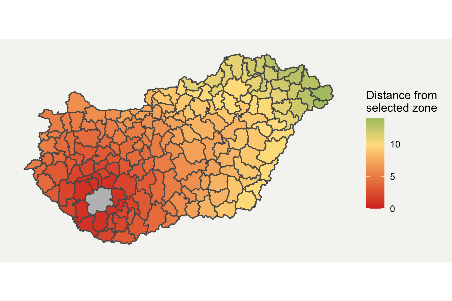
Visualising Neighbouring Polygons in R
Guide on how to make neighbouring boundary maps in R.
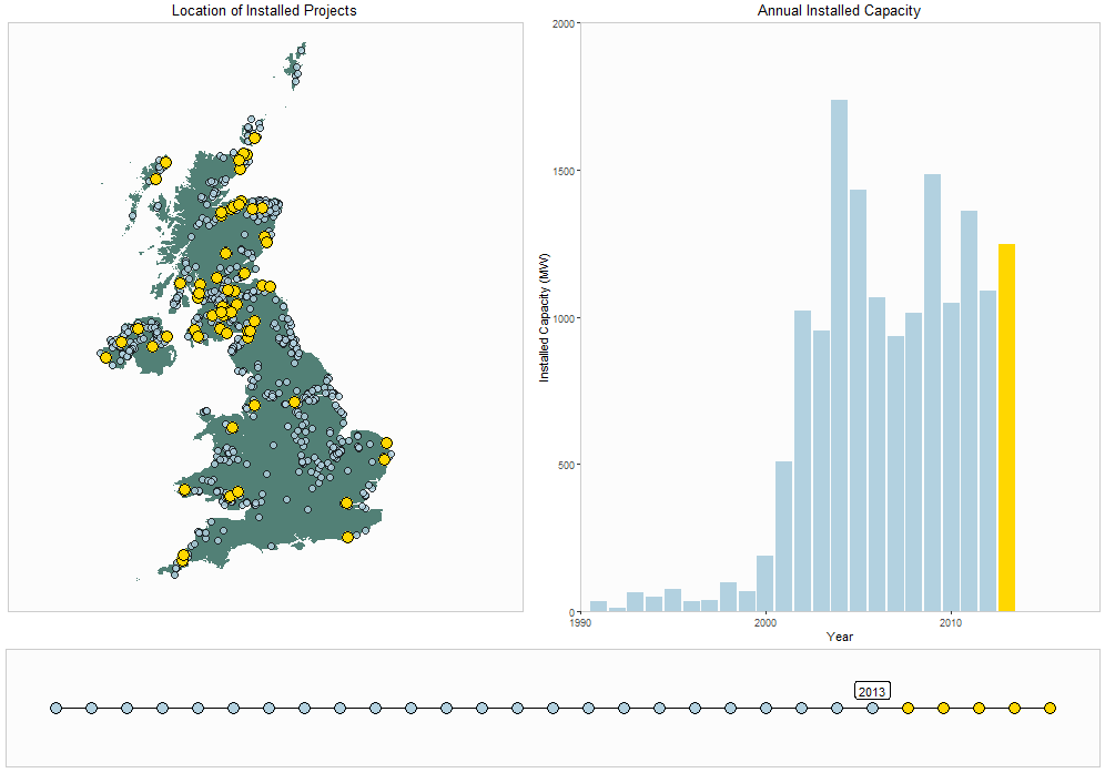
Animated Plots with R
Some examples of using animated plots with geospatial data.
Using R for Geospatial Data Analysis
Although R is widely used for data processing and statistical modelling, it is less frequently known for its powers of handing Geospatial Data. This presentation is aimed to show people the benefits of using R in their analyses, and provides practical guidance on how to get started on your first project.
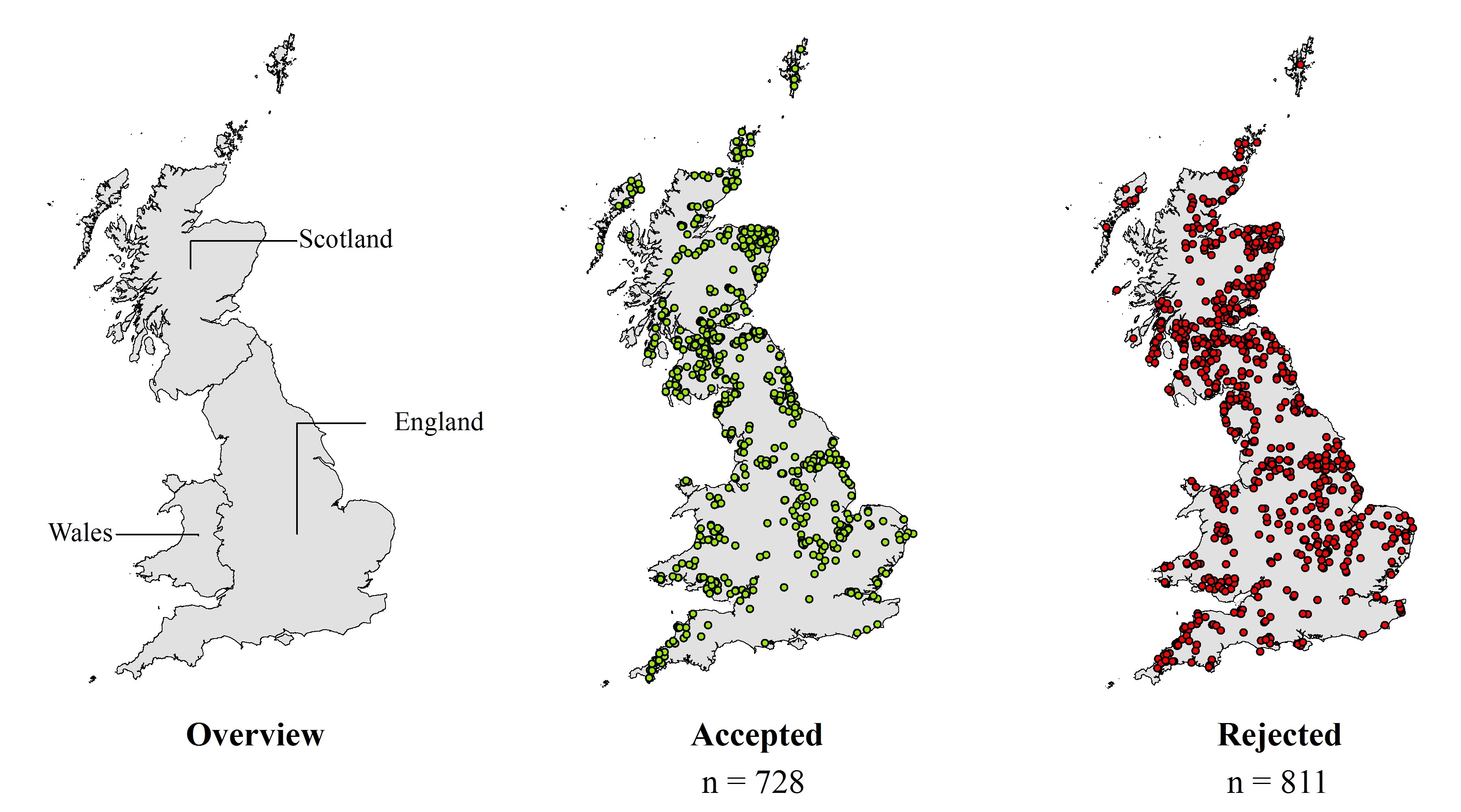
Identifying key influences for planning acceptance of onshore wind turbines
Conference paper presented at ECOS 2017 on my research into understanding why some wind farms are more successful than others.

Cycling Lands End to John O'Groats
Back in May 2016, a friend and I undertook one of the challenges which we had wanted to do for years and cycled the length of the United Kingdom from Land's End to John O' Groats. It was a fantastic experience and something I would love to do again one day. This blog provides a summary of our trip and aims to aid anyone who may be planning their own trip.